


Ireland
Travel Maps International Adventure Map
Seiten
2011
National Geographic Maps (Verlag)
978-1-56695-535-5 (ISBN)
National Geographic Maps (Verlag)
978-1-56695-535-5 (ISBN)
- Titel z.Zt. nicht lieferbar
- Versandkostenfrei innerhalb Deutschlands
- Auch auf Rechnung
- Verfügbarkeit in der Filiale vor Ort prüfen
- Artikel merken
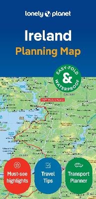
AdventureMaps provide global travellers with the perfect combination of detail and perspective. The north side of the Ireland map details from the northernmost tip of the island at Malin Head south to Dublin and Galway, including Belfast, Londonderry, and Sligo. The south side covers the remainder of the country including the cities of Limerick, Tralee, Cork, and Waterford. An inset map provides detail of the Skellig Islands. Sites of interest from prehistoric monuments and castles to churches and abbeys are noted making this map indispensable for the inquisitive traveller.
Founded in 1915 as the Cartographic Group, the first division of the National Geographic Society, National Geographic Maps has been responsible for illustrating the world around us through the art and science of mapmaking. Today, National Geographic Maps continues this mission by creating the world's best wall maps, recreation maps, atlases, and globes which inspire people to care about and explore their world. All proceeds from the sale of National Geographic maps go to support the Society's non-profit mission to increase global understanding and promote conservation of our planet through exploration, research, and education.
| Verlagsort | Evergreen |
|---|---|
| Sprache | englisch |
| Maße | 108 x 233 mm |
| Gewicht | 95 g |
| Themenwelt | Reisen ► Karten / Stadtpläne / Atlanten ► Europa |
| Reiseführer ► Europa ► Irland | |
| ISBN-10 | 1-56695-535-1 / 1566955351 |
| ISBN-13 | 978-1-56695-535-5 / 9781566955355 |
| Zustand | Neuware |
| Haben Sie eine Frage zum Produkt? |
Mehr entdecken
aus dem Bereich
aus dem Bereich
Karte (gefalzt) (2024)
Lonely Planet Global Limited (Verlag)
7,45 €