


Philip's Europe Road Map
with high speed rail
2025
Philip's (Verlag)
978-1-84907-701-9 (ISBN)
Philip's (Verlag)
978-1-84907-701-9 (ISBN)
- Noch nicht erschienen (ca. Januar 2025)
- Versandkostenfrei innerhalb Deutschlands
- Auch auf Rechnung
- Verfügbarkeit in der Filiale vor Ort prüfen
- Artikel merken
For all your holiday and travel needs, the latest up-to-date edition of Philip's super-clear map of Europe.
'The Clearest and Most Detailed Maps of Europe' David Williams MBE, former CEO Gem Motoring Assist
The perfect all-inclusive map for planning and using on your European Road Trip:
- The Main scale is super-clear 1: 3,890,000 (61 miles to 1 inch)
- All of Europe is covered from Southern Portugal to Northern Russia
- Fully updated with all the latest information for travelling in Europe
- Map of Europe's High-speed railways
- Handy Weather Maps for both Summer and Winter travels
- City-to-City Distance Table for estimating your journeys
- All the important information for motoring: motorways (toll, pre-pay and free), mountain passes, railways, road numbers (European and local), distances between towns
In fact, everything you need for driving in Europe. Every country is covered from Portugal to Russia and it is a double-sided map for easy in-car use. Follow the sun (or the snow) and make the most of this small, but extraordinarily culture-packed continent.
Philip's has been at the forefront of creating maps and atlases since 1834. Whether a local street map or a fact-packed World Atlas, we use the most up-to-date technology, expertise and our global network to ensure our customers have all the information they need.
| Erscheint lt. Verlag | 2.1.2025 |
|---|---|
| Reihe/Serie | Philip's Sheet Maps |
| Verlagsort | London |
| Sprache | englisch |
| Maße | 118 x 236 mm |
| Themenwelt | Reisen ► Karten / Stadtpläne / Atlanten ► Europa |
| ISBN-10 | 1-84907-701-0 / 1849077010 |
| ISBN-13 | 978-1-84907-701-9 / 9781849077019 |
| Zustand | Neuware |
| Haben Sie eine Frage zum Produkt? |
Mehr entdecken
aus dem Bereich

aus dem Bereich
Karte (gefalzt) (2023)
Freytag-Berndt und ARTARIA (Verlag)
12,90 €
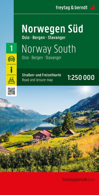
Straßen- und Freizeitkarte 1:250.000
Karte (gefalzt) (2023)
Freytag-Berndt und ARTARIA (Verlag)
12,90 €
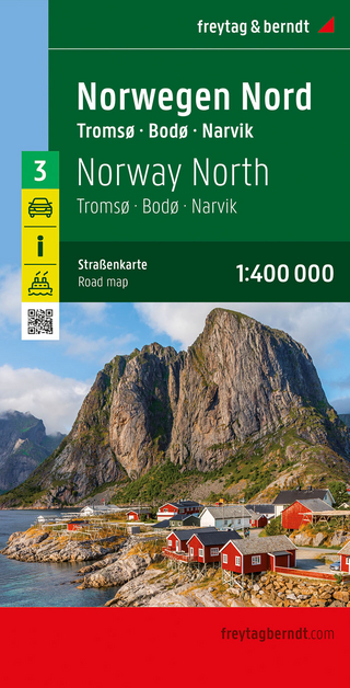
Narvik
Karte (gefalzt) (2023)
Freytag-Berndt und ARTARIA (Verlag)
12,90 €